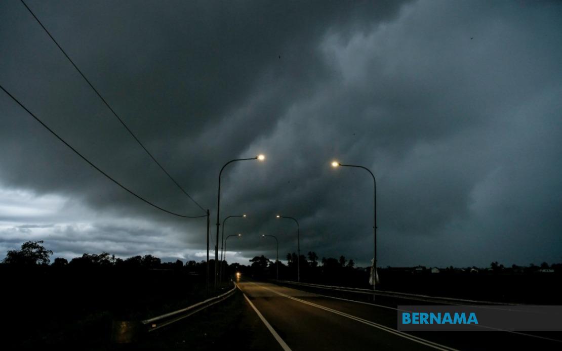
The Malaysian Meteorological Department has activated a comprehensive weather alert system covering a significant swathe of the country, warning residents across nine states and Labuan of potentially dangerous atmospheric conditions expected to persist through the evening. The advisory, which takes effect immediately, cautions of thunderstorms accompanied by heavy downpours and gusty winds that could disrupt daily activities and pose hazards to both motorists and pedestrians across affected regions.
The northern region faces particularly extensive exposure, with MetMalaysia placing all of Perlis under alert status. Several districts within Kedah are also covered, including the popular island destination of Langkawi alongside interior zones such as Kubang Pasu, Kota Setar, Pokok Sena, Padang Terap, Sik and Baling. The Perak alert encompasses both coastal and inland areas, extending across Kerian, Larut, Matang and Selama, before moving into the state's more densely populated central regions of Kuala Kangsar, Kinta and Kampar, suggesting the system is advancing southeastward across peninsular Malaysia.
The warnings extend into Peninsular Malaysia's eastern and central regions with particular intensity. Pahang's high-elevation zones, including the popular Cameron Highlands tourist destination alongside lowland areas such as Bentong, Bera and Rompin, fall within the alert perimeter. Selangor's Hulu Langat district, a region prone to flash flooding during heavy precipitation events, has also been flagged for concern. Negeri Sembilan's interior districts of Jelebu and Jempol, combined with Johor's southeastern zones encompassing Segamat, Kluang and Mersing, face similar weather challenges, creating a concentrated band of high-risk areas across the peninsula's lower half.
East Malaysia faces equally significant threats from the developing weather pattern. Sarawak's alert covers an expansive geographic area spanning both coastal and interior zones. The coverage includes Kuching division's outlying areas of Bau, the Serian region, and Samarahan division's districts of Samarahan and Asajaya. Further upriver, the Sarikei, Sibu and Mukah divisions fall under the warning, while interior Sarawak is represented by Kapit's Song and Kapit districts. The northern coastal areas around Bintulu, encompassing Tatau and Sebauh, together with Miri's Marudi district and the northernmost Limbang territory, face heightened risk from the approaching weather system.
Sabah's exposure extends across multiple geographic zones reflecting the state's diverse topography. Interior regions including Sipitang, Kuala Penyu, Beaufort and Tambunan face particular vulnerability given their exposure to orographic enhancement of rainfall. The west coast corridor, encompassing Sabah's most densely populated areas, has also been placed under alert. Sandakan division's interior districts of Tongod and Kinabatangan, situated along major river valleys, represent additional zones of concern where water management and flood risk management will become critical during the warning period.
The temporal constraint of the warning—lasting only until 9 pm—suggests that MetMalaysia's meteorologists have identified a discrete weather system expected to move through the region during the evening hours rather than a prolonged multi-day event. This relatively short window may indicate a fast-moving thunderstorm complex or a squall line associated with the existing atmospheric circulation patterns typical for this season. However, even brief but intense thunderstorm systems can produce significant impacts including flash flooding in low-lying areas, disrupted transportation networks, and dangerous lightning strikes.
Residents and businesses across the affected regions should take precautionary measures immediately, particularly those in flood-prone zones and areas with elevated rainfall vulnerability. Outdoor activities and non-essential travel should be postponed until the warning concludes. Motorists navigating affected highways should exercise heightened caution, as reduced visibility combined with potential aquaplaning risks could precipitate accidents. Utility providers and emergency response agencies across all affected states should implement enhanced monitoring protocols to respond rapidly to any incidents arising from the severe weather conditions.
The geographic distribution of this alert reflects the current atmospheric setup across Malaysia and Southeast Asia during the southwest monsoon transition period. The warning's scope—encompassing areas from the northernmost Perlis through to Sabah and Sarawak's most remote interior—indicates a fairly broad pressure system influencing weather patterns rather than isolated local convection. This widespread nature suggests that residents should remain alert to weather updates throughout the afternoon and evening, as conditions could intensify or shift unexpectedly.
MetMalaysia's decision to issue specific district-level alerts rather than blanket state warnings demonstrates the increasing sophistication of Malaysian meteorological forecasting. This granular approach allows local authorities and residents to calibrate their responses more precisely, reducing unnecessary disruption in unaffected areas while concentrating resources and precautions where they are genuinely needed. The public is advised to monitor official MetMalaysia updates and local news channels for any extensions or modifications to the current alert as the weather system develops throughout the afternoon and evening hours.