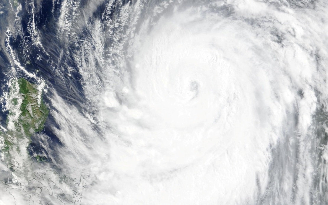
Taiwan's Central Weather Bureau escalated its alert status on Thursday afternoon as Typhoon Bavi continued its powerful approach toward the island nation, prompting authorities to issue a comprehensive sea warning that will likely be followed by a land warning early the following morning. The announcement underscored growing concerns about the trajectory and intensity of the ninth typhoon to form during the current season, as meteorologists tracked its steady northwestern movement across the waters of the western Pacific.
The maritime warning issued at 2.30 pm specifically targeted vulnerable coastal regions and surrounding waters, encompassing the northeastern and southeastern approaches to Taiwan's coast. The protective zones extended to include Orchid Island and Green Island, two populated outlying territories that lie directly in the potential path of the approaching system. The Bashi Channel, a strategically important waterway separating Taiwan from the Philippines, was also incorporated into the alert area, reflecting the wide geographical scope of the expected impact.
At the time of the warning's issuance, Bavi maintained a position to the southeast of Eluanbi, Taiwan's southernmost geographical point, while gradually advancing in a northwesterly direction toward the main island. This trajectory placed the storm system on a course that would bring it closer to populated areas within the coming day, prompting the decision to activate maritime restrictions and prepare civilian populations for potential landfall conditions.
The typhoon displayed considerable meteorological intensity, with sustained maximum winds recorded at 51 metres per second in the immediate vicinity of its core circulation. More concerning to forecasters were the extreme gusts being generated by the system, which reached peak velocities of 63 metres per second, creating dangerous conditions across a broad area surrounding the typhoon's centre and indicating a well-organized and energetic weather system.
Based on contemporary tracking models and atmospheric analysis, meteorologists projected that Bavi would continue advancing northwestward at a moderate pace of between 15 and 20 kilometres per hour. This forward speed suggested the storm would transition from a sea threat to a land threat relatively quickly. Forecasters anticipated that while the typhoon would pass north of Taiwan rather than making a direct hit on the island's centre, the system would still impact the territory as either a powerful strong typhoon or a particularly intense moderate typhoon, depending on slight variations in the final track and any additional intensification or weakening.
The imminent arrival of this severe weather system had already begun disrupting the region's transportation infrastructure even before landfall. Airlines operating between Taiwan and Okinawa, a major travel corridor supporting both tourism and business connections, cancelled most scheduled services to avoid exposing aircraft and passengers to deteriorating conditions. The precautionary cancellations extended beyond regional flights, with several long-haul international services also suspended as carriers repositioned aircraft to safer locations and rescheduled operations.
Maritime transport networks similarly faced significant disruption, with ferry operators implementing comprehensive suspensions across multiple routes that normally carry both passengers and cargo between Taiwan and other parts of the region. These service interruptions reflected the dangerous sea state conditions anticipated along the crossing routes, where waves and wind from the approaching typhoon would create hazardous navigation conditions.
Land-based transportation networks also faced operational challenges as authorities implemented alert status on mountain roads and highland routes that traverse Taiwan's interior terrain. The elevated elevation areas that characterize much of Taiwan's central and eastern regions present particular hazards during typhoon passages, as steep topography can channel winds into dangerous corridors and increase the risk of landslides, flooding, and debris falls that render highways impassable and threaten the safety of vehicle occupants.
For Malaysia and other Southeast Asian nations, the development of Typhoon Bavi carries broader meteorological significance, as the movements and behaviour of major western Pacific typhoons can influence regional weather patterns and may affect shipping routes that are vital to regional trade. The situation also serves as a reminder of Taiwan's vulnerability to extreme weather systems and the sophisticated forecasting and emergency management capabilities that island nations in the region must maintain to protect their populations and economic interests.

