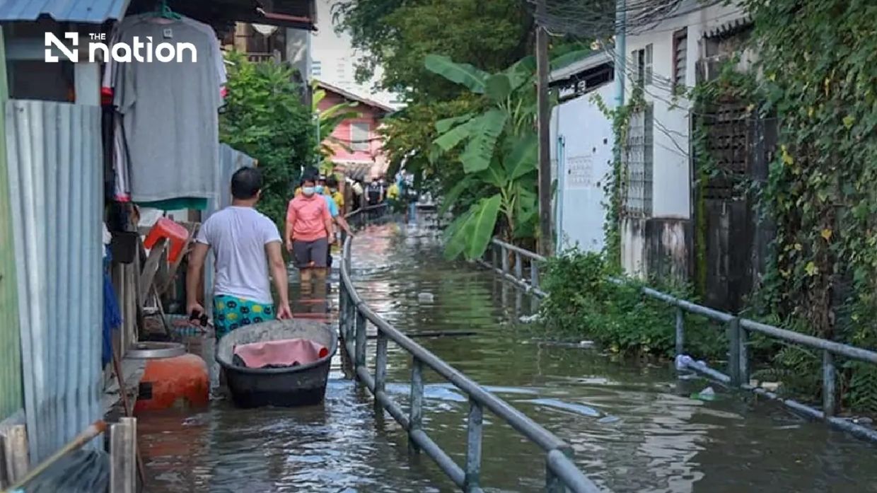
Thailand's Department of Disaster Prevention and Mitigation has sounded the alarm for Bangkok and six surrounding central provinces—Pathum Thani, Nonthaburi, Nakhon Pathom, Samut Sakhon, Samut Songkhram, and Samut Prakan—as forecasts predict a concerning spike in tidal levels during the peak of the monsoon season. The alert, issued on Saturday, covers a week-long period beginning Monday through the following Sunday, during which meteorological conditions are expected to drive sea levels significantly higher than normal, creating conditions ripe for flooding along the Chao Phraya River and its interconnected canal network.
Theerapat Kachamat, who heads the disaster mitigation agency, confirmed at midday Saturday that his department was actively monitoring hydrographic data from the Royal Thai Navy to track the developing situation. The Navy's specialists had detected elevated water patterns around Phra Chulachomklao Fort and adjacent stretches of the Chao Phraya, where computerized models predict sea levels will crest between 6 in the evening and 10 at night throughout the alert period. This nightly timing is particularly concerning because it coincides with human activity along the waterways and makes real-time monitoring more challenging for authorities and residents alike.
The mechanics of the anticipated flooding pattern reflect Thailand's geography and seasonal weather cycles. When high tides coincide with monsoon rains and upstream river discharge, the cumulative water volume strains the capacity of natural and engineered channels. Water pressure builds along riverbanks and spills into adjoining canals, potentially inundating low-lying residential areas, informal settlements, and commercial zones that lack permanent flood barriers or adequate drainage infrastructure. Communities positioned in the floodplain between the river and established protective dikes face particular vulnerability, as do informal neighborhoods outside formal flood defense systems.
Specific districts across the alert zone have been identified as facing elevated risk. In Pathum Thani, officials are focusing on Mueang Pathum Thani and Sam Khok districts. Nonthaburi's Mueang Nonthaburi, Pak Kret, and Bang Kruai districts are under observation. Nakhon Pathom province encompasses Bang Len, Nakhon Chai Si, and Sam Phran districts in the warning zone. Samut Songkhram, the smallest of the provinces mentioned, faces threats across all its districts. Samut Prakan's Mueang Samut Prakan, Phra Samut Chedi, Phra Pradaeng, and Bang Bo districts round out the geographic scope. For many communities in these areas, such warnings have become a seasonal routine, yet the danger remains acute and demands fresh preparedness.
Provincial governments have received explicit instructions to communicate the threat directly to residents and business operators with riverside exposure. The disaster agency has instructed authorities to broadcast specific times when tides will peak, allowing people to take precautionary measures such as moving valuable goods to higher floors, securing boats and barges, and positioning pumps and sandbags. Private sector entities—particularly those operating floating restaurants, conducting riverbank fortification work, and managing water-based commerce—must maintain heightened awareness. The coordination requirement extends beyond government to include these commercial actors whose operations depend on the rivers but whose infrastructure can either worsen or mitigate flooding impacts.
The Central Disaster Prevention and Mitigation Command has mobilized multiple communication channels to reach the public. Residents can access real-time warnings through the official THAI DISASTER ALERT mobile application, which has become the primary information tool for Thai communities during seasonal hazards. The app provides location-specific alerts and updates as conditions evolve, reducing reliance on inconsistent social media rumors or delayed official statements. This technological approach reflects Thailand's recognition that modern disaster response depends on rapid information dissemination to diverse populations across wide geographic areas.
For those experiencing actual flooding or requiring emergency assistance, Thailand has established dedicated response mechanisms. Citizens can report incidents and request aid through LINE messaging by adding the account @1784DDPM, a platform choice reflecting how communication habits have shifted toward instant messaging rather than phone calls. Simultaneously, the traditional 1784 safety hotline remains staffed around the clock to handle callers who prefer voice contact or lack mobile messaging capability. This dual-channel approach ensures that emergency requests reach coordinators regardless of the resident's age, technology comfort level, or circumstances.
The alert underscores broader challenges facing Thailand's urban and peri-urban areas in the Chao Phraya basin. Unlike northern or northeastern regions where flooding often results from heavy rainfall and overflow of inland rivers, the Bangkok metropolitan zone faces a compound threat: monsoon rains from upstream combine with tidal pushback from the Gulf of Thailand, creating a hydraulic squeeze that conventional drainage systems struggle to manage. Climate science has documented that sea levels in Southeast Asian coastal zones are rising relative to land in many areas, a process that amplifies the danger from high-tide events that would have posed lesser threats a generation ago.
For Malaysian observers, Thailand's approach to tidal flooding warnings carries relevance given similarities in monsoon patterns and coastal geography. The Strait of Malacca and peninsular Malaysia's western and eastern coasts experience their own seasonal tidal variations and flood risks, though geography and infrastructure differ from the Bangkok situation. Nevertheless, Thailand's experience demonstrates the necessity of maintaining alert systems during peak monsoon periods and the importance of pre-positioning resources before flooding occurs rather than attempting emergency responses once water has already breached defenses. The coordination between military hydrographic services and civilian disaster agencies also reflects a regional pattern where civil-military cooperation supports public safety infrastructure.
The week ahead will test the readiness of local officials, community leaders, and residents across the seven jurisdictions named in the alert. While not all areas under warning will experience catastrophic flooding—tidal surge severity varies by microtopography and local conditions—the potential for significant disruption to business operations, transportation, utilities, and daily life remains genuine. Communities that heed the guidance and prepare in advance typically experience fewer economic losses and injuries than those caught unprepared. The alert system, though imperfect, represents Thailand's attempt to provide the lead time necessary for protective action.

