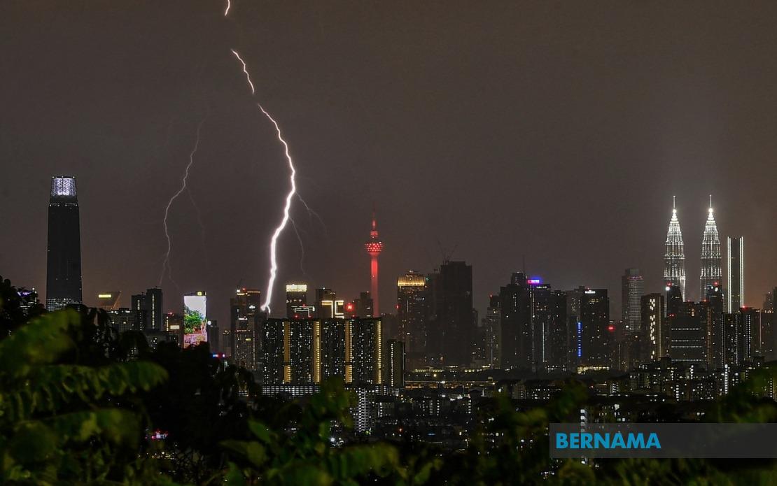
The Malaysian Meteorological Department has issued an urgent weather alert covering a broad swathe of the peninsula, warning residents in Kuala Lumpur and eight states to brace for severe thunderstorm activity accompanied by heavy downpours and gusty winds throughout the afternoon. The alert, issued at 2 pm, remains in effect until 5 pm as an atmospheric system moves across the region, potentially affecting transportation, outdoor activities and utilities across multiple population centres.
The alert encompasses the entire states of Melaka and Penang, two of the nation's most densely populated regions. In Melaka, all areas fall under the warning, suggesting residents should prepare for widespread disruptions. Penang, similarly affected in its entirety, faces potential flooding risks given the state's topography and urban infrastructure, particularly in low-lying districts of Penang Island and the mainland.
In Kedah, the northern state most vulnerable to weather systems crossing from the Strait of Melaka, five districts have been flagged: Kuala Muda, Sik, Baling, Kulim and Bandar Baharu. These areas, spanning both coastal plains and inland agricultural zones, could experience localized flooding and disrupted harvesting activities if the rainfall proves as intense as forecast.
Perak presents a more complex warning pattern, with MetMalaysia identifying ten distinct districts across the state including Kerian, Larut, Matang and Selama in the northern plains, alongside central highland regions such as Hulu Perak and Kuala Kangsar, and the industrial corridor encompassing Kinta, Kampar, Batang Padang and Muallim. This geographic spread reflects the storm system's anticipated impact across Perak's varied terrain, from coastal areas to mountainous terrain.
In Pahang, six districts warrant attention: Cameron Highlands, the high-altitude hill station popular with tourists; Lipis and Raub in the interior; Bentong on the western edge; and Pekan and Rompin in the eastern coastal regions. Residents and visitors in Cameron Highlands should exercise particular caution given the area's elevation and terrain, where heavy rainfall can quickly trigger landslides and flash flooding in valleys and residential areas.
The Klang Valley region in Selangor, home to Malaysia's economic hub, faces potentially disruptive weather across seven districts including the highly urbanized Klang, Gombak, Petaling and Hulu Langat areas. These densely developed zones with extensive road networks and commercial activity could experience traffic congestion, flooding in underpasses and temporary service interruptions. Sabak Bernam and Kuala Selangor, the state's coastal districts, may also experience storm surge effects alongside heavy precipitation.
Negeri Sembilan's Jelebu district and Johor's southern and eastern districts including Tangkak, Segamat, Muar, Batu Pahat, Kluang and Mersing are similarly braced for the system's passage. These areas represent a cross-section of Johor's geography from the western agricultural plains to the eastern coastal tourism regions, suggesting the weather front maintains significant geographic extent and intensity.
For Malaysian readers and businesses operating across these regions, the alert carries material implications. Commuters should anticipate delays and exercise heightened caution on roads, particularly in areas prone to flash flooding such as Klang Valley underpasses and highland roads in Cameron Highlands. Outdoor events, construction sites and agricultural operations should implement contingency protocols. Shipping and port operations in affected coastal areas may experience disruptions.
MetMalaysia's advisory to remain vigilant and monitor updated forecasts reflects the inherent unpredictability of tropical weather systems. Atmospheric conditions can intensify or weaken rapidly, and the geographic spread of the warning—spanning from Kedah in the north to Johor in the south—underscores the system's substantial spatial influence. Residents should maintain awareness of local flood-prone areas and have contingency plans for power outages or transport disruptions.
The timing of this alert during afternoon hours, when daytime heating reaches its peak, may amplify thunderstorm intensity. The combination of moisture-laden air, atmospheric instability and anticipated wind shear could generate isolated severe convection with locally intense rainfall in brief periods, posing flash flood risks even in areas not traditionally flood-prone.
Authorities in affected states and federal territories should activate emergency response protocols and ensure drainage systems are functioning optimally. Public utility companies should prepare for potential service disruptions from lightning strikes or waterlogging of equipment. Schools and businesses should consider early closure or flexible arrangements if conditions deteriorate.
The broad geographic scope of this warning—affecting major population centres, agricultural regions, tourist destinations and industrial zones simultaneously—highlights how rapidly tropical weather systems can develop regional impacts. Residents across the peninsula are advised to treat this warning seriously, secure loose outdoor items, charge portable power banks, and maintain communication access as precautionary measures during the critical afternoon hours.

