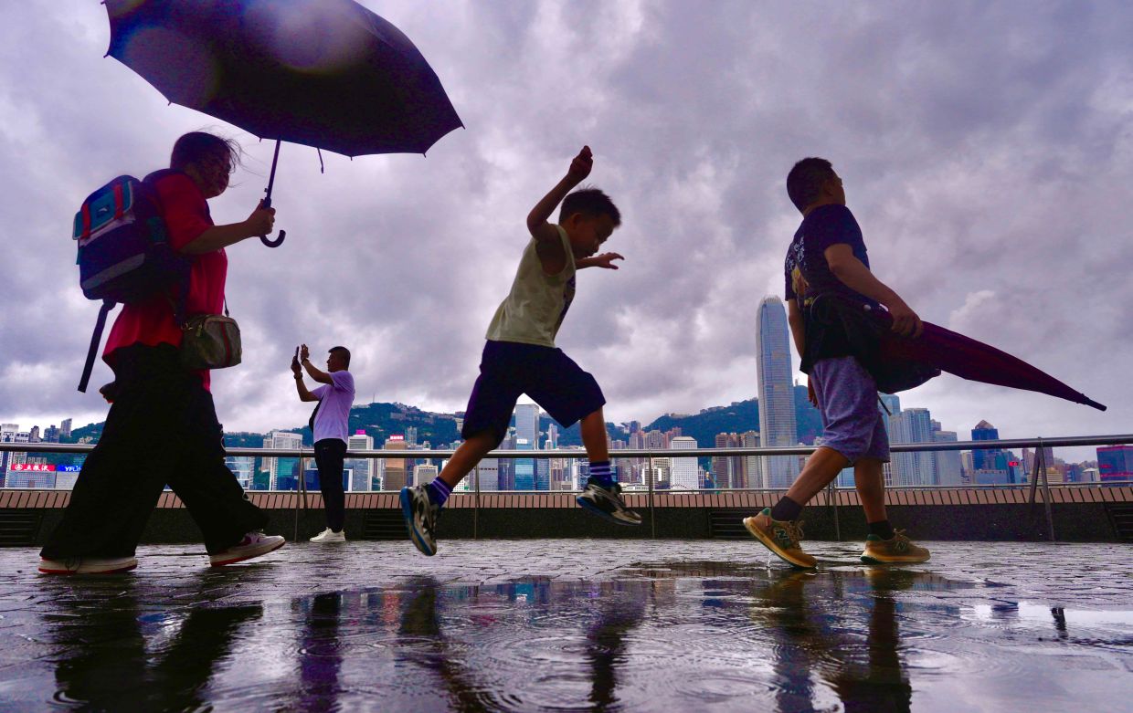
Hong Kong residents woke Friday morning to the sound of heavy rainfall that would break a grueling weeklong heat wave that had left the city sweltering under unprecedented summer temperatures. The downpour, beginning at 8:40 am and accompanied by squally thunderstorms throughout the day, prompted the Hong Kong Observatory to activate an amber rainstorm alert—the lowest tier of the territory's weather warning system. By mid-morning, as showers continued, the alert was withdrawn three hours after it was issued, signaling that the most intense precipitation had passed, though forecasters expected additional showers to persist into the afternoon and evening hours.
The meteorological conditions that delivered the much-needed rainfall stemmed from upper-air disturbances combined with a southwesterly airstream that swept across the territory. These atmospheric features, typical of August weather patterns in the region, finally broke the stranglehold that high-pressure systems had maintained over Hong Kong throughout the previous week. The arrival of moisture-laden winds from the southwest created the conditions necessary for cloud formation and precipitation, offering a stark contrast to the hot, dry conditions that had dominated the forecast for the preceding seven days.
The timing of the rain could hardly have been more welcome. Hong Kong had endured an extraordinary surge in temperatures that saw numerous districts recording readings well above the 34-degree Celsius mark as the heat accumulated day after day. The relentless nature of the warm spell set the territory apart from typical summer weather, creating conditions more reminiscent of peak heat seasons in other subtropical regions. Residents struggled with the intensity and duration of the heat, which showed little sign of abating before Friday's welcome relief arrived.
The significance of this heat episode became clear when meteorological records were examined. The Hong Kong Observatory reported that maximum temperatures at its central monitoring station had remained at or exceeded 33 degrees Celsius for nine consecutive days—a record-breaking streak for August that underscored the extraordinary nature of the weather event. This extended duration of intense heat, rather than a single spike, demonstrated how persistent and suffocating the atmospheric conditions had become, with little opportunity for nighttime cooling or temporary respite during the day.
The magnitude of the temperature records broken became even more apparent when the absolute maximum reading was announced. On a day earlier in the week, the observatory logged a peak of 36.9 degrees Celsius—the highest temperature recorded since the institution began systematic temperature documentation in 1884. This milestone represented not merely a seasonal record but rather the most extreme heat Hong Kong had experienced in the entire 140-year history of its meteorological observations. The figure served as a stark reminder of how climate patterns can shift and intensify, pushing environmental limits to new extremes.
Looking ahead, forecasters indicated that the respite from the intense heat would be temporary in nature. Saturday's outlook included morning thunderstorms in some areas, with sunny intervals expected during daylight hours, suggesting an unsettled but gradually improving pattern. However, meteorologists warned that very hot weather was poised to return early in the following week, signaling that Friday's rainfall would provide only a brief interruption to the underlying warm atmospheric regime that had gripped the territory.
For Southeast Asian observers, Hong Kong's experience serves as a cautionary tale about the intensifying heat patterns that can grip the region during summer months. The breaking of multiple heat records in a single week reflects broader trends in regional climate patterns that have seen more frequent and intense heat episodes across East and Southeast Asia in recent years. Malaysia, situated in the equatorial and tropical zones, has similarly experienced increasing temperatures and more extreme weather variability, making the Hong Kong situation relevant to understanding regional climate dynamics.
The incident also highlights the importance of robust meteorological infrastructure and early warning systems in densely populated urban centers. Hong Kong's Observatory, with its long historical record and sophisticated monitoring capabilities, was able to track the heat wave's progression and provide timely alerts about the incoming rain. Such institutional capacity enables cities and regions to prepare residents and implement heat response measures, though the challenge remains acute when records are broken so comprehensively.
The broader implications for the region extend beyond immediate weather forecasting. The convergence of upper-air disturbances and monsoon-influenced wind patterns that brought Friday's relief is part of larger seasonal circulation systems that affect Malaysia and other Southeast Asian nations. Understanding how these atmospheric features evolve and intensify has implications for water management, agricultural planning, and public health preparedness across the region. As climate patterns continue to shift, the ability to anticipate and respond to extreme weather events becomes increasingly crucial for vulnerable populations in densely settled areas.
For Hong Kong residents contemplating the coming week, the pattern forecast suggests a pendulum effect—swinging from record-breaking heat to temporary relief, then back toward intense conditions. This volatility underscores the challenges posed by extreme weather events and the importance of maintaining urban infrastructure resilience, adequate water supplies, and public health systems capable of responding to rapid atmospheric changes that may bring either excessive heat or heavy rainfall within short timeframes.

