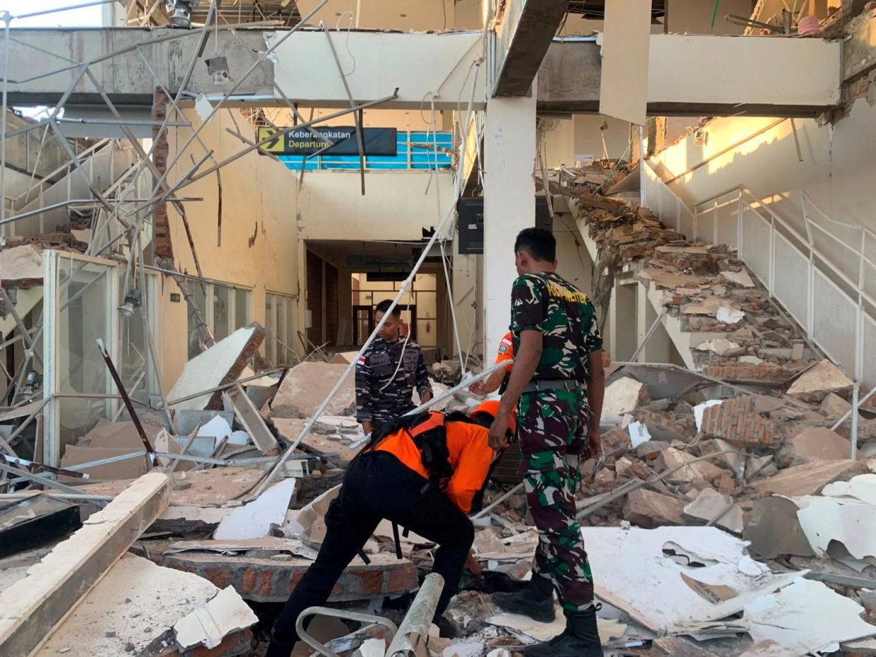
Indonesia's disaster-prone Flores region experienced a severe jolt early Saturday when a magnitude 7.7 earthquake struck offshore, destroying buildings and claiming at least two lives while leaving a trail of structural damage and widespread panic across the island. The tremor, recorded at 5:58 a.m. local time on August 15, originated approximately 68 kilometres north-northwest of the city of Ende in East Nusa Tenggara province, with its epicenter positioned just 10 kilometres beneath the seabed, making it a particularly destructive shallow-crustal event that transferred considerable energy to surface structures.
The initial shock triggered an immediate chain of emergency responses from Indonesian authorities, who rapidly issued a tsunami warning for multiple provinces including East Nusa Tenggara, West Nusa Tenggara, South Sulawesi and Southeast Sulawesi. Coastal residents received urgent directives to evacuate beaches and riverbanks, with particular emphasis on moving inland to elevated terrain where potential waves could not reach. However, relief came relatively swiftly when Indonesia's Meteorology, Climatology and Geophysics Agency completed its monitoring assessment and determined that observed sea-level changes posed no meaningful threat to coastal populations, allowing the precautionary alert to be stood down within hours of the initial quake.
Eyewitness accounts from residents across Flores island painted a picture of sudden chaos and significant property destruction. Yohanna Embu, a Sikka regency resident, described watching numerous structures sustain heavy damage as the ground shook violently, with frightened residents instinctively rushing toward higher elevations in search of safety. She specifically noted the collapse of the waiting room facility at Maumere's port terminal, a public building designed to handle passenger traffic, illustrating how the quake's force affected both residential and commercial infrastructure indiscriminately.
The religious community experienced particularly harrowing moments at St. Peter Major Seminary, locally known as Ritapiret Seminary, where students and nuns were gathered for morning Mass when disaster struck. Rev. Guidelbertus Tanga, the seminary's rector, recounted how the assembly hall's roof gave way as people attempted to flee, forcing worshippers to escape beneath collapsing structural elements. The incident resulted in at least one priest suffering a broken leg after jumping from a second-storey building in his desperation to reach ground level before further collapse occurred.
Medical facilities across the affected region activated emergency protocols to protect patients and staff from potential aftershocks. Video footage captured scenes of hospital personnel rapidly evacuating patients from interior rooms, moving essential medical equipment including beds, intravenous stands and oxygen cylinders to outdoor areas where temporary treatment zones were hastily assembled. This precautionary mobilisation reflected the institutional memory of medical professionals working in a tectonically volatile region, prioritising patient safety over the disruption caused by evacuation.
The U.S. Geological Survey's analysis confirmed the quake's substantial magnitude and shallow depth characteristics, factors that combine to produce particularly severe ground shaking and structural damage compared to deeper earthquakes of similar magnitude. The initial earthquake was succeeded by multiple aftershocks, a pattern typical of subduction zone activity, creating ongoing danger for residents in damaged buildings and complicating rescue and recovery operations that followed the primary event.
Preliminary casualty figures from the Maumere Search and Rescue Agency documented at least two confirmed deaths and two additional injuries, though these figures represented only initial assessments conducted in the hours immediately following the quake. Broader structural damage surveys across Flores island remained ongoing, with the full scope of destruction and final casualty counts still being compiled as search and rescue teams accessed remote and hard-to-reach communities.
Indonesia's geographic positioning along the Pacific Ring of Fire places the nation among the world's most seismically active regions, a consequence of its location atop multiple converging tectonic plates. The archipelago's sprawling geography, encompassing more than 17,000 islands distributed across an enormous maritime area, compounds both earthquake hazard and disaster response complexity, requiring sophisticated coordination among national and provincial authorities to protect scattered populations.
The Flores region carries particularly poignant historical significance in Indonesia's earthquake record. In December 1992, a catastrophic earthquake-generated tsunami struck the southeastern island of Flores, killing approximately 2,500 people in what remains one of the region's deadliest natural disasters. That tragic precedent explains the immediate tsunami warnings issued following Saturday's quake and the substantial public anxiety that accompanied the initial alert—Flores residents retain living memory of tsunami devastation and understand their vulnerability to compound disasters where earthquakes trigger secondary wave hazards.
Saturday's earthquake underscores the persistent challenge facing Indonesian policymakers and urban planners: how to develop infrastructure and communities in seismically active zones while minimising human casualties and economic losses. Building codes, early-warning systems and public emergency preparedness programmes remain critical interventions, particularly in eastern Indonesia where dense settlement patterns, limited resources and challenging terrain complicate disaster mitigation efforts. The seminary collapse and structural failures observed across Maumere raise ongoing questions about construction standards and enforcement in regions prone to major seismic events.

