Authorities in southwestern China have traced a devastating mudslide that struck the border town of Gyirong Port on August 26 to its origins in Nepal's high mountain terrain. The disaster began when a glacier on the southern face of Mount Langtang Lirung fractured at approximately 5,200 metres altitude, releasing an enormous mass of ice and rock that cascaded downward with tremendous velocity. This finding, announced at a press conference by the Xizang regional government, marks a critical moment in understanding how climate-related hazards are reshaping the Himalayan landscape with increasingly severe cross-border consequences.
The initial avalanche descended rapidly through the mountainous terrain, dropping roughly 1,200 metres as it accelerated toward lower elevations. As the ice and rock mass tumbled down the slopes, it accumulated additional debris from the mountainside, transforming from a contained avalanche into an enormous mudflow that gathered destructive force and volume. By the time this debris torrent had traversed the remaining distance across the steep terrain, it had evolved into a massive mud surge capable of obliterating everything in its path.
The mudflow's journey proved remarkably extensive, covering approximately 22 kilometres across the challenging topography before finally reaching Gyirong Port, situated at roughly 1,800 metres elevation. This extraordinary distance underscores the tremendous energy involved in the catastrophe and demonstrates how rapidly debris flows can travel across Alpine terrain under specific hydrological and gravitational conditions. The fact that the destructive material originated in Nepal yet reached a Chinese settlement highlights the interconnected nature of mountain hazards across the Himalayan region, where geological and meteorological processes respect no political boundaries.
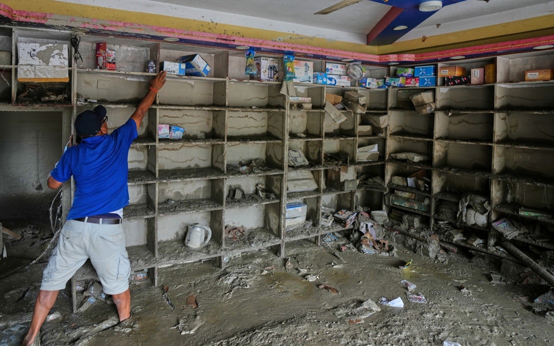
The impact on Gyirong Port was severe and comprehensive. The mudslide flattened approximately 0.7 square kilometres of the settlement, destroying 27 structures including buildings and supporting facilities. The scale of destruction reflects the tremendous kinetic energy possessed by the debris flow after its 22-kilometre descent, with the momentum and force sufficient to obliterate permanent structures. As of Saturday evening, confirmed casualties stood at 16 deaths, though an additional 546 individuals remained unaccounted for, suggesting the true toll of the disaster remained uncertain in the immediate aftermath.
The investigation that identified the Nepalese glacier as the culprit involved sophisticated scientific analysis by experts specializing in mountain hazards. The cryosphere emergency disaster response team from the Institute of Mountain Hazards and Environment, operating under the Chinese Academy of Sciences, deployed advanced remote-sensing technology to monitor the affected region. Their methodology combined satellite imaging data with field observations, allowing them to reconstruct the sequence of events and pinpoint the precise location where the catastrophe originated. This multidisciplinary approach represents current best practice in Alpine disaster investigation and provides valuable insights into transnational mountain hazards.
The identification of a cross-border trigger for this disaster carries significant implications for regional cooperation and disaster management planning. Nepal and China, both nations with extensive high-altitude territories, must now contend with mounting evidence that extreme events in one country's mountains can devastate communities in another. The 5,200-metre fracture point in Nepal's glacial system directly caused casualties and destruction in Chinese territory, raising questions about early warning systems, monitoring infrastructure, and international protocols for managing such transnational risks. For Malaysia and other Southeast Asian nations with regional stakes in the area, this incident underscores the importance of understanding how climate change and glacial dynamics in distant mountains may ultimately affect broader Asian geopolitical and humanitarian relationships.
The triggering glacier's location on Mount Langtang Lirung's southern slope is particularly significant within the context of climate science and mountain hazard evolution. The Langtang Himal region has experienced notable glacier retreat and instability in recent decades as temperatures have risen across the Himalayan arc. Scientists have increasingly documented how warming temperatures destabilize glacial masses through processes including accelerated surface melting, internal refreezing cycles that alter structural integrity, and lubrication of subglacial surfaces that reduce friction. The fracture at 5,200 metres may reflect broader climatic stresses acting upon high-altitude ice masses throughout the region, suggesting that similar events could occur elsewhere along the Himalayan chain.
The debris flow transformation process represents a critical phase in the disaster's development that would have been poorly visible to observers watching from the mountain slopes. As the initial avalanche descended, the force of its impact against the mountainside and the mechanical grinding action of the rapidly moving material against rock and soil generated friction heat and initiated the mobilization of additional surface debris. Water, either from the melting ice itself or from saturated ground layers encountered during descent, became incorporated into the mass, converting the avalanche into a flowing slurry. By the time the material reached lower elevations where gradients decreased, the accumulated volume and momentum created a self-sustaining flow capable of persisting across significant distances.
The precise measurement that the debris flow traveled approximately 22 kilometres from its source to the settlement represents a remarkable feat of disaster reconstruction. This distance testifies to the extraordinary conditions created by such events—the velocity required to transport massive quantities of rock and mud across such terrain, the volume of material mobilized from the mountainside, and the available water content that lubricated the mass and sustained its movement. The fact that destructive force remained concentrated enough to flatten structures at the terminus of this journey indicates that the flow had not significantly dispersed or lost energy despite the distance traversed and elevation change encountered.
For Malaysia's geographic and development context, this Himalayan catastrophe offers cautionary lessons about the potential for climate-driven hazards in mountainous regions to generate cascading regional impacts. Southeast Asia contains numerous high-altitude areas—including portions of Malaysia's own terrain—where glaciers, although currently absent or confined to the highest peaks in neighboring regions, remain subjects of scientific concern as climate patterns shift. More broadly, understanding how extreme events originating in distant mountain ranges can propagate across borders reminds policymakers that disaster management and climate adaptation cannot be effectively conducted within purely national frameworks. The cross-border mudslide from Nepal to Xizang exemplifies how integrated regional approaches to mountain hazard monitoring and early warning systems represent increasingly critical infrastructure for contemporary Asia.
The response to this disaster has already mobilized significant Chinese state resources and scientific expertise, but the international character of the triggering event raises questions about future cooperation frameworks. Early warning systems capable of detecting imminent glacial instability on Nepal's slopes might, in theory, provide downstream communities in China with critical additional time to evacuate. Such systems would require intensive monitoring, substantial investment in sensor networks and satellite infrastructure, and, crucially, established diplomatic channels and information-sharing protocols between nations. The tragedy at Gyirong Port demonstrates that the technical capability to trace disaster origins—as shown by the Chinese Academy of Sciences team—must eventually evolve into capability to predict and forestall such events through genuinely integrated Himalayan mountain monitoring and disaster management systems.

