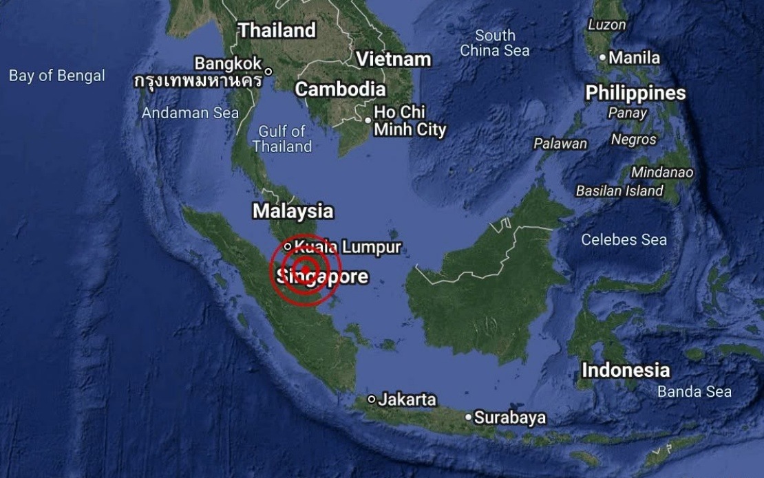
A moderate earthquake with a magnitude of 3.1 shook the waters off Batu Pahat in Johor on August 25, occurring at 4.12 pm local time. The Malaysian Meteorological Department (MetMalaysia) swiftly assessed and documented the seismic event, providing updates through its National Weather and Earthquake Operations Centre. The epicentre was pinpointed at 1.7 degrees north latitude and 102.8 degrees east longitude, positioning the tremor approximately 18 kilometres to the south-west of Batu Pahat town.
The occurrence, though notable enough to be recorded and reported to the public, falls within the range of earthquakes regularly monitored across the Southeast Asian region. Malaysia's location on the periphery of major tectonic zones means that seismic activity, while not as frequent or severe as in areas closer to fault lines, remains part of the natural geological landscape. The Batu Pahat region, situated in the southern part of Peninsular Malaysia's Johor state, occasionally experiences minor tremors as seismic waves propagate across the region from more distant sources.
MetMalaysia's immediate response to classify the event and rule out tsunami hazards reflects the operational protocols established by Malaysian authorities to safeguard coastal communities. Following any submarine earthquake, particularly those occurring in waters near populated coastlines, monitoring agencies automatically assess whether conditions exist for tsunami generation. In this instance, the moderate magnitude and location of the epicentre did not present such risks to Malaysian waters or neighbouring regions. The agency's statement explicitly clarified that no tsunami threat existed, providing reassurance to residents in coastal areas.
The timing of the earthquake in late afternoon hours meant that it likely occurred during working hours and may have been felt by residents and workers in Batu Pahat and surrounding districts. The 3.1 magnitude rating, while representing a notable tremor, typically does not cause significant structural damage or widespread disruption in modern buildings. Most people in the vicinity would have felt movement, particularly those on upper floors of buildings or in areas with sensitive instruments, though reports of damage or injuries from such moderate earthquakes remain uncommon in Malaysia.
Seismic monitoring in Malaysia serves multiple purposes beyond immediate hazard detection. MetMalaysia's continuous tracking of earthquakes contributes to the broader scientific understanding of regional geological dynamics and helps build a historical record of seismic activity patterns. This data proves valuable for urban planners and construction engineers working on major infrastructure projects, particularly those in proximity to coastal zones or major water bodies. The systematic documentation of events like the Batu Pahat earthquake enriches the database available to researchers studying the tectonics of Southeast Asia.
For Malaysian readers and those living or working in Johor, such earthquakes, while infrequent enough to warrant public notification, remain generally manageable phenomena that do not typically disrupt daily life significantly. The state has experienced occasional seismic activity throughout its recorded history, and building codes have evolved to account for these possibilities. The broader context of living in a region with moderate seismic risk differs markedly from zones such as Japan, Indonesia, or the Philippines, where far more severe and frequent earthquakes occur regularly.
The National Weather and Earthquake Operations Centre, the body responsible for issuing official statements on seismic events, maintains 24-hour vigilance and possesses sophisticated monitoring networks distributed across Malaysian territory. This institutional capacity ensures that any significant seismic events occurring in or near Malaysian waters receive prompt professional assessment. The centre's ability to quickly rule out tsunami dangers reflects both technological capability and trained personnel expertise in interpreting seismic data rapidly.
MetMalaysia's statement, issued through official channels on the same day as the earthquake, exemplifies the standard procedure for public communication regarding natural hazards. By confirming the absence of tsunami risk explicitly, the agency prevents potential panic while maintaining transparency about what occurred. This measured approach to hazard communication builds public confidence in official institutions and reduces unnecessary anxiety among residents who may have felt the tremor.

