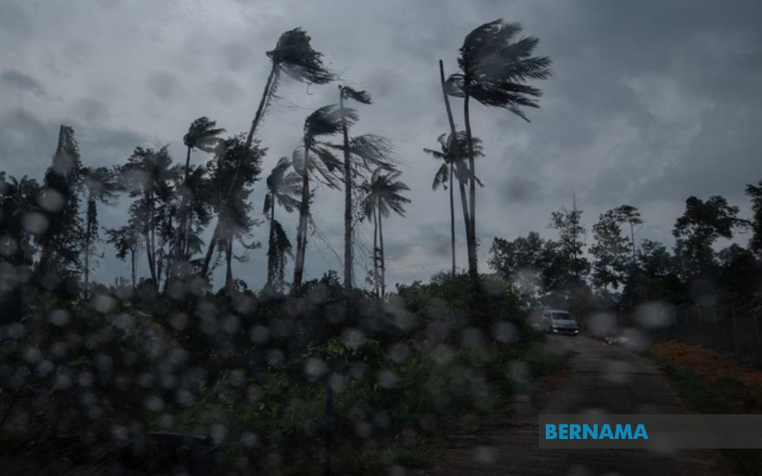
The Malaysian Meteorological Department issued a significant weather alert early this morning, cautioning residents across multiple states to prepare for thunderstorms, heavy rain and strong winds throughout the morning hours. The alert, released at 8:35 am, applies to a broad swath of the country stretching from the northern peninsula down to southern regions, as well as portions of Sarawak on the island of Borneo. Residents in affected areas have been advised to take precautions and remain vigilant as atmospheric conditions deteriorate during this period.
On the northern peninsula, the entire states of Perlis and Melaka have been placed under the weather warning. Additionally, three districts in Kedah—Langkawi, Kubang Pasu and Kota Setar—are expecting the severe conditions to develop. These northern and coastal regions are particularly vulnerable to sudden atmospheric disturbances given their geography and seasonal weather patterns, making timely warnings essential for public safety.
The warning extends significantly into the central peninsula, encompassing three major areas in Pahang: Kuantan, Pekan and Jerantut. Selangor's exposure includes Sepang and Kuala Langat, both strategically important areas that serve as gateways to the capital region. In Negeri Sembilan, five districts face the threat: Port Dickson, Seremban, Rembau, Kuala Pilah and Tampin, representing a substantial portion of the state's populated zones.
The southern peninsula has not been spared from the forecast either. Two districts in Johor—Tangkak and Muar—are positioned directly in the path of the approaching weather system. These areas, serving as important commercial and transportation hubs in the southern region, may experience disruptions to daily activities should the storms intensify as predicted.
On the East Malaysian side, Sarawak's inland and coastal regions have also been flagged by MetMalaysia. Nine areas are covered by the alert: Mukah, Selangau, Sibu, Sarikei, Maradong, Bintulu, Kapit, Bukit Mabong and Subis in Miri. This comprehensive coverage indicates that the meteorological department detected a significant weather system capable of affecting diverse geographic zones simultaneously, reflecting the scale of the atmospheric disturbance.
MetMalaysia classified this as a short-term weather warning, the lowest tier in terms of duration but not necessarily severity. By definition, such alerts remain valid for no longer than six hours from issuance, ensuring that the forecast reflects current atmospheric conditions rather than extended projections. The 1pm deadline suggests meteorologists expect conditions to stabilize or shift by early afternoon, though residents should monitor official updates continuously.
The combination of thunderstorms, heavy rain and strong winds presents multiple hazards to the public. Thunderstorms can produce lightning strikes, pose risks to outdoor workers and expose areas to flash flooding in low-lying zones. Heavy rainfall may overwhelm drainage systems and create hazardous driving conditions, while strong winds can damage structures, down tree branches and disrupt power lines. The simultaneous occurrence of all three elements amplifies the overall risk profile for affected communities.
For Malaysian commuters and business operators, such weather alerts carry practical implications. Morning rush hour traffic patterns may be disrupted as visibility decreases and road conditions deteriorate. Construction sites, outdoor markets and open-air commercial activities typically experience slowdowns. School activities and public events scheduled for the affected hours face potential postponement or cancellation, requiring coordination between authorities and institutions.
MetMalaysia's decision to issue the alert at 8:35 am provides a roughly four-hour window for residents and authorities to prepare. This advance notice, while relatively brief, allows for essential measures such as securing loose outdoor items, adjusting traffic management, cancelling outdoor gatherings and ensuring emergency response teams are on heightened alert. The specificity of the geographic coverage demonstrates the department's refined forecasting capabilities, enabling targeted warnings rather than blanket advisories.
The affected regions encompass both urban centres and rural zones, necessitating coordinated response mechanisms. Urban areas with sophisticated drainage infrastructure may fare better than rural communities with less developed systems. Transportation networks in major cities like Kuala Lumpur, Seremban and Sibu will require traffic management adjustments. Agricultural areas and farming communities across these zones may experience temporary disruptions to harvesting or other outdoor operations.
Residents are generally advised to stay indoors during the peak of the storm, avoid driving unless absolutely necessary, keep emergency supplies accessible and maintain awareness of local weather updates. Coastal regions, particularly those in Langkawi and other vulnerable areas, should exercise heightened caution given the potential for rapid water level changes. Electrical safety becomes paramount during thunderstorms, prompting residents to unplug non-essential appliances and avoid using mobile phones during lightning activity.
The alert underscores the importance of continuous meteorological monitoring in a tropical nation where sudden weather changes are commonplace. MetMalaysia's proactive warning system allows both individuals and institutions to make informed decisions that prioritise safety. As climate patterns evolve regionally, such forecasting capabilities become increasingly critical for disaster preparedness and public welfare across Malaysia's diverse geographic landscape.

