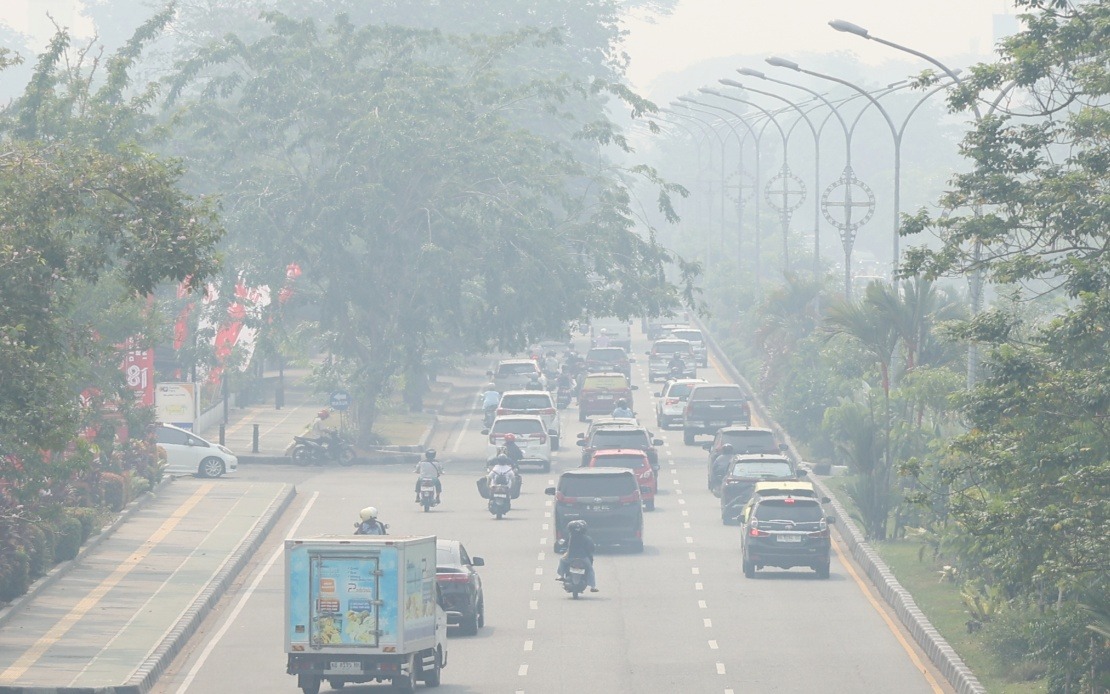
Indonesia's environmental crisis has deepened dramatically as ongoing forest and land fires push air quality to dangerous thresholds across multiple regions. The Air Pollutant Index has surged to an alarming 573 in Jekan Raya, a subdistrict within Palangka Raya in Central Kalimantan, according to readings recorded from 17 monitoring stations. This represents a critical threat to public health, prompting urgent intervention from Indonesian government agencies and raising concerns for neighbouring Southeast Asian nations including Malaysia, which routinely experiences transboundary haze from Indonesian fires.
The scale of the pollution emergency extends far beyond Central Kalimantan's most affected areas. Muaro Jambi Regency in Jambi province has also registered hazardous API levels at 302, while multiple other locations across Sumatra and Kalimantan are grappling with very unhealthy air quality ratings between 201 and 300. These zones include Pelalawan in Riau, Penukal Abab Lematang Ilir and Ogan Ilir in South Sumatra, Southeast Pontianak in West Kalimantan, and both Gunung Mas and Katingan in Central Kalimantan. The geographic spread demonstrates that this is not a localized problem but rather a regional catastrophe affecting vast populations across Indonesia's two largest islands.
Health Ministry Environmental Health Director Then Suyanti conveyed stark warnings about the risks posed by such elevated pollution levels. She emphasized that in areas where the API has reached hazardous thresholds, the public must entirely avoid outdoor activities due to the severe health consequences. For regions experiencing very unhealthy air quality, she advised residents to minimize time spent outdoors, particularly vulnerable populations including children, elderly persons, and those with pre-existing respiratory or cardiovascular conditions. The distinction between hazard categories reflects different risk profiles, with hazardous readings representing an immediate threat to all population groups regardless of health status.
The Indonesian government has mobilized a comprehensive response to mitigate the public health crisis. The Health Ministry is preparing a circular expected to be issued within days by its secretary-general, outlining protective measures for the population. Among the most significant policy adjustments is permission for schools to transition to distance learning when air quality deteriorates to dangerous levels, acknowledging that children constitute one of the most vulnerable demographic groups. This administrative flexibility recognizes the genuine peril posed by prolonged exposure to severely polluted air, particularly for developing lungs.
The human toll of the disaster remains contained thus far but represents a serious warning of potential escalation. According to Agus Jamaludin, Head of the Health Crisis Centre, approximately 3.4 million people across seven provinces have been affected by the fires and resulting haze. These provinces span both Sumatra and Kalimantan, including Riau, Jambi, and South Sumatra on Sumatra island, alongside West, Central, East, and South Kalimantan. All affected provinces have declared emergency alert status rather than full emergency response status, indicating authorities are preparing for potential deterioration while maintaining operational flexibility. To date, 42 individuals have sustained minor injuries related to the fires, while two individuals in South Kalimantan suffered serious burn injuries requiring hospitalization. Notably, no deaths or mass evacuations have been reported, though the situation remains fluid.
Government resource deployment reflects the scale of the emergency response required. The Health Ministry has stationed 321 health personnel across all affected provinces, positioning medical capacity to respond to potential surges in pollution-related illnesses. This distributed approach recognizes that different regions face varying pollution intensities and thus require localized medical capacity. The presence of trained personnel across multiple provinces enables rapid response to health emergencies arising from severe air exposure while supporting baseline public health surveillance throughout the crisis period.
Satellite monitoring data reveals the ongoing and expansive nature of the fire threat across Indonesia's archipelago. The Forestry Ministry detected 805 high-confidence hotspots and 11,313 medium-confidence hotspots nationwide as of late Tuesday, indicating that new fire ignition and spread continues unabated. Among the six priority provinces, South Sumatra recorded the highest concentration of high-confidence hotspots with 239 separate locations, followed by Central Kalimantan with 113, South Kalimantan with 89, and West Kalimantan with 86. Jambi and Riau registered significantly lower numbers at seven and one respectively, though these figures may reflect detection capabilities or geographic variation rather than actual fire absence. The disparity between high-confidence and medium-confidence hotspot distributions demonstrates both the intensity and uncertainty in fire monitoring.
The medium-confidence hotspot distribution reveals a distinctly different geographic pattern. West Kalimantan leads dramatically with 2,447 medium-confidence hotspots, followed by Central Kalimantan with 2,168, South Sumatra with 1,161, and South Kalimantan with 710. Jambi and Riau trail significantly with 197 and 199 respectively. This pattern suggests that while South Sumatra contains the most intense confirmed fires, West Kalimantan faces the highest number of potential fire locations requiring verification and monitoring. The sheer volume of these hotspots indicates that firefighting efforts face an enormous operational challenge spanning thousands of individual fire locations across vast territories.
For Malaysian and broader Southeast Asian audiences, this crisis carries particular significance given the region's history of transboundary haze pollution. Indonesian forest fires routinely send smoke and ash across maritime boundaries, affecting air quality in Malaysia, Singapore, and Brunei. The severity of the current API readings in Indonesia's border regions—particularly in West and Central Kalimantan near Malaysian territory—suggests potential for significant transboundary haze events. Malaysian environmental agencies and public health authorities typically monitor Indonesian fire activity closely during burning seasons, as previous fires have triggered air quality emergencies in Sarawak and Sabah, occasionally reaching hazardous levels. The current fire situation warrants heightened vigilance across the region.
The persistence of thousands of active or potential hotspots across six provinces indicates that this environmental disaster may continue intensifying before improving. Fire management authorities face the dual challenge of actively suppressing existing flames while preventing new ignitions across vast expanses of peatland and forest. Peatland fires prove particularly difficult to extinguish due to deep soil combustion, meaning that even extinguished surface fires may reignite weeks later. The combination of extensive hotspot distribution, atmospheric conditions conducive to fire spread, and ongoing land clearance activities suggests that air pollution may remain at problematic levels for an extended period. Neighbouring countries should prepare for potential extended haze impacts and coordinate regional responses to this transnational environmental crisis.
The governmental measures announced thus far represent necessary but potentially insufficient responses to an escalating crisis. While emergency status declarations and health personnel deployment demonstrate institutional awareness, the fundamental challenge remains controlling thousands of dispersed fires across multiple provinces simultaneously. International cooperation mechanisms, including potential air quality alert systems shared among ASEAN nations and coordinated firefighting assistance, may prove essential if the crisis intensifies further. The coming weeks will determine whether current containment efforts succeed in reducing fire frequency and intensity, or whether worsening conditions trigger more severe public health interventions and regional haze events.

