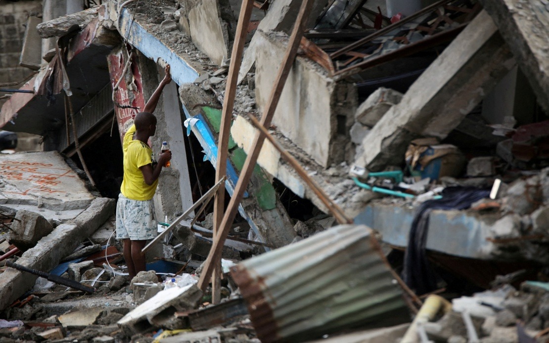
Colombia is grappling with a catastrophic convergence of natural disasters that has stretched emergency services to breaking point. In the span of a week, the nation has endured a powerful 7.4 magnitude earthquake followed by a dramatic surge in wildfire activity that saw 344 municipalities declared under red alert conditions—representing a staggering 93 per cent single-day increase in fire threat assessments. The timing of these calamities has created a perfect storm for disaster management agencies already overwhelmed by the magnitude of earthquake recovery operations.
The wildfire crisis emerged amid exceptionally punishing weather conditions characterised by scorching temperatures and severe drought across critical regions. According to the Institute of Hydrology, Meteorology and Environmental Studies (IDEAM), the rapid proliferation of active fires has been driven by environmental factors that show no signs of relenting. The conflagrations have concentrated their destructive force in six departments: Tolima, Cesar, Norte de Santander, Antioquia, Narino and Santander, each grappling with multiple simultaneous fire fronts that require constant attention and resources.
The scale of destruction from the fires alone is staggering. Preliminary assessments indicate that vegetation, agricultural land and residential properties spanning more than 11,000 hectares have been consumed or severely damaged across multiple municipalities. This represents not merely an environmental catastrophe but a severe blow to agricultural productivity and rural livelihoods in regions already struggling economically. The loss of cropland will have ripple effects on food security and rural incomes for months or years to come, creating secondary humanitarian concerns beyond the immediate disaster response phase.
Responding to this escalating crisis, Colombian authorities have mobilised an extensive array of emergency resources. Firefighting crews, military personnel and aerial support units have been deployed in a coordinated effort to establish containment lines and prevent further spread. However, officials have acknowledged critical staffing shortages that severely hamper operations. Firefighters from affected regions, including those from Risaralda—itself damaged by the August 10 earthquake—have been conscripted into fire suppression operations, yet even these additional deployments leave the service stretched dangerously thin across the affected territories.
The earthquake that preceded this wildfire outbreak has left a devastating humanitarian footprint. Official tallies record 288 fatalities with 4,018 injured from the seismic event, while structural damage extends far beyond total destruction. Approximately 12,504 homes have been completely destroyed, yet the broader picture of damage is even more troubling: more than 80,000 structures sustained damage ranging from moderate to severe. This means hundreds of thousands of people remain displaced or living in compromised housing, precisely when emergency personnel should be consolidating recovery efforts rather than pivoting to manage an entirely separate crisis.
Looking forward, meteorological projections suggest that relief may be distant. The IDEAM has calculated a 90 per cent probability that El Niño conditions will persist through the first quarter of 2027, with peak heat anomalies forecast to intensify toward the end of 2024. This outlook is particularly troubling for fire management, as sustained elevated temperatures create ideal conditions for fire initiation and spread. The confluence of ongoing El Niño effects with post-earthquake debris fields creates an environment where fire risk will remain elevated throughout the critical recovery period.
Complicated further by monitoring requirements at the Purace volcano in Cauca department, Colombia's disaster management apparatus must simultaneously track and respond to multiple major natural hazards. The heightened volcanic activity introduces a third thread to an already fraying emergency response fabric, forcing the National Unit for Disaster Risk Management to divide its analytical and operational capacity across earthquake recovery, wildfire suppression and volcanic monitoring. This tripartite challenge represents one of the most complex disaster scenarios a nation can face.
For regional observers, Colombia's predicament underscores the vulnerability of nations in the Pacific Ring of Fire and tropical belt to cascading natural disasters. Southeast Asian countries with similar seismic profiles and climate patterns—particularly the Philippines, Indonesia and Malaysia—should study this situation with urgent attention. The compressed timeline between disasters reveals critical gaps in disaster preparedness, resource stockpiling and mutual aid arrangements that typically assume sequential rather than simultaneous events. When multiple major emergencies strike within days rather than months, pre-positioned supplies deplete rapidly and trained personnel reach exhaustion.
The international dimensions of this crisis merit attention as well. Cross-border fire smoke and ash effects may impact neighbouring nations, while the humanitarian burden exceeds Colombia's domestic capacity. Regional cooperation mechanisms and international disaster relief coordination become essential when a single nation faces the compounding weight of earthquake recovery and large-scale wildfire suppression simultaneously. The situation serves as a practical demonstration of why regional disaster management frameworks and pre-negotiated mutual assistance agreements between neighbouring countries represent critical infrastructure investments.

