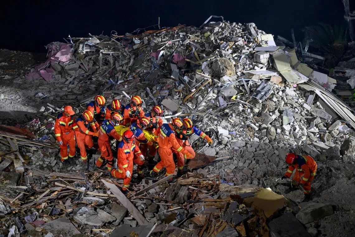
Rescue operations in southwestern China have intensified dramatically as teams employ explosive charges to clear towering boulders obstructing their path to 34 people unaccounted for since a catastrophic landslide struck on Friday during intense monsoon rains. The emergency effort, captured in footage by state media CCTV, represents a critical escalation in what officials describe as the "deep rescue phase" of the disaster response in Penghua County, approximately 270 kilometres from Chongqing's central urban sprawl.
The geological calamity has claimed eight lives to date, with the full toll likely to mount as recovery operations progress through difficult terrain near the Wujian river. The mountainous township, home to roughly 500,000 people, depends on communities perched precariously along steep hillsides where construction and population density compound the region's inherent vulnerability to natural disasters. Authorities have already evacuated more than 1,100 residents from the immediate vicinity, recognising the acute danger posed by secondary collapses and ongoing geological instability.
President Xi Jinping's directive to pursue methodical, science-based rescue protocols underscores Beijing's determination to extract survivors and conduct a thorough investigation into the disaster's origins. This top-level intervention signals the seriousness with which national leadership views the crisis and reflects broader governmental concern about escalating environmental hazards in China's rapidly developing regions. The explicit call for rigorous investigation suggests authorities intend to scrutinise whether inadequate construction practices or land management failures contributed to the catastrophe.
The immediate area presents profound challenges for rescue teams. Photographic and video evidence reveals an entire mountainside collapsing into the river, severing the narrow township's main thoroughfare and rendering normal access routes impassable. Recovery crews have established geological assessment teams to identify hidden structural vulnerabilities and monitor for potential secondary disasters—a critical consideration given the unstable conditions and ongoing precipitation forecast across multiple provinces through the week.
China's geographical and climatic characteristics make it exceptionally prone to landslide disasters. Mountains, hills, and plateaus constitute approximately two-thirds of the nation's landmass, while intense summer monsoons combine with rapid urbanisation and intensive construction to create perfect conditions for slope failure. The region surrounding this disaster is particularly vulnerable due to abundant groundwater from heavy rainfall and the legacy of extensive industrial development and infrastructure projects that have altered natural drainage patterns and destabilised previously stable slopes.
The current weather situation exacerbates anxieties about additional disasters. Authorities have issued warnings as eight minor and medium-sized rivers across Yunnan, Guangxi, Guangdong, Anhui, and Shanghai currently exceed official flood warning thresholds. Meteorological forecasts predict sustained heavy to torrential rainfall across multiple provinces, prompting officials to implement enhanced protective measures in high-risk zones and accelerate evacuation protocols in vulnerable communities. The combination of saturated soil conditions, swollen waterways, and ongoing precipitation creates a cascade of interconnected hazards threatening residents across vast stretches of southern and central China.
Historical precedent underscores the scale of potential loss in major landslide events. Over the past decade, landslide incidents have claimed approximately 294 lives across at least five substantial disasters nationwide. The most devastating occurred in December 2015 when an industrial waste pile collapsed at a construction site in Shenzhen, the southern technology hub, killing more than 70 people. That catastrophe exposed how rapid economic development and inadequate site management can transform industrial areas into lethal hazard zones, a lesson that continues to resonate through current emergency response protocols.
The intersection of environmental stress and infrastructure vulnerability defines contemporary disaster risk in China's development zones. Rapid urbanisation, while economically transformative, has fundamentally altered hydrological systems, removed stabilising vegetation from hillsides, and concentrated population density in inherently unstable locations. Construction activities themselves frequently destabilise slopes through excavation, water disruption, and weight redistribution, creating cascading vulnerabilities that persist for years after projects complete.
For Southeast Asian nations, particularly those with mountainous terrain and rapidly developing economies—such as Malaysia, Thailand, and the Philippines—China's repeated disasters offer sobering lessons about balancing growth with geological and environmental risk management. Many ASEAN countries face comparable challenges: dense populations in hilly regions, seasonal monsoon flooding, intensive construction pressure, and limited resources for comprehensive geological monitoring. The technical and operational approaches Chinese authorities deploy during these crises, despite their troubling frequency, warrant close regional attention as neighbouring countries refine their own disaster preparedness frameworks and building code enforcement mechanisms.

